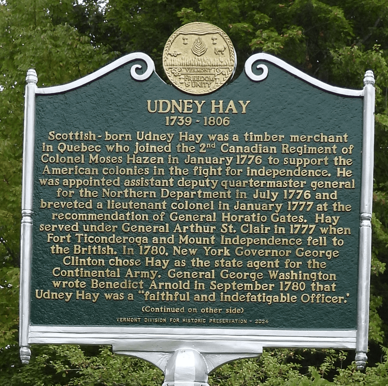
On Saturday September 13, 2025 a dedication ceremony was held for the Udney Hay historic marker set at the site of his original Underhill residence.
Category Archives: Uncategorized
Antebellum Underhill – Hope Greenberg
Hope Greenberg presents an intimate picture of rural community life in Underhill in the antebellum years prior to the Civil War.
Stevensville Cabin
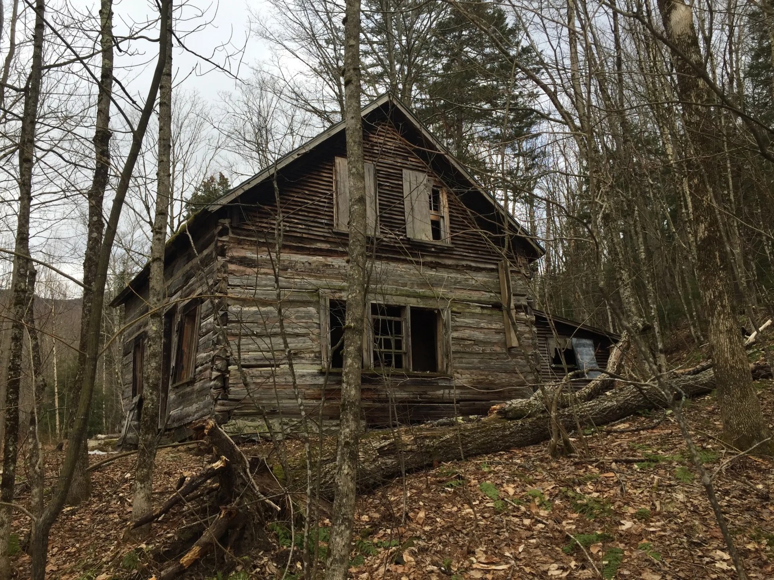
The Stevensville Cabin, built in the 1830s and originally known as the H. Hicks Farm after Hiram Hicks, is one of very few remaining 19th century log cabins in the state. Dating from Stevensville’s early logging days, it is representative of a unique era in Underhill history. Through the help of generous donations, the cabinContinue reading “Stevensville Cabin”
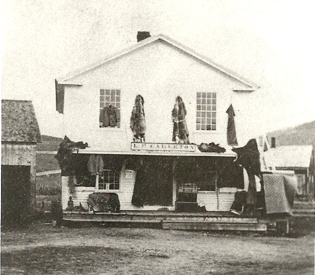
One-Room Schoolhouses 1787-1953 Districts No. 1-15
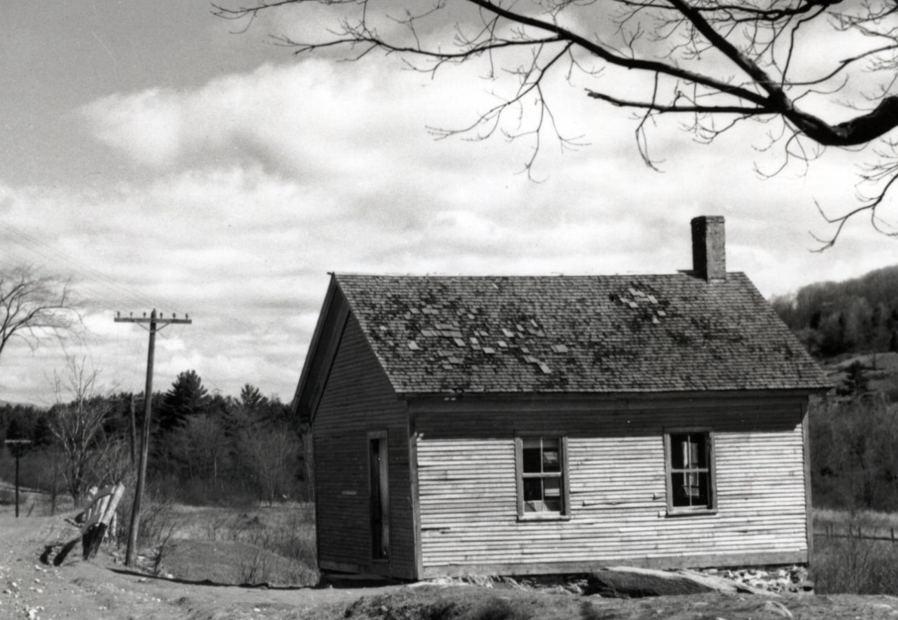
For schoolhouse locations, see interactive map here Who Built/Paid for the Schools and Maintained Them? Think of the 15 Districts like neighborhoods. The parents of the students largely built the schools and did upkeep as needed. However, in reading selectboard reports/school committee reports there were years when they postponed repairs due to lack of consensusContinue reading “One-Room Schoolhouses 1787-1953 Districts No. 1-15”
The Underhill Resolutions 1798
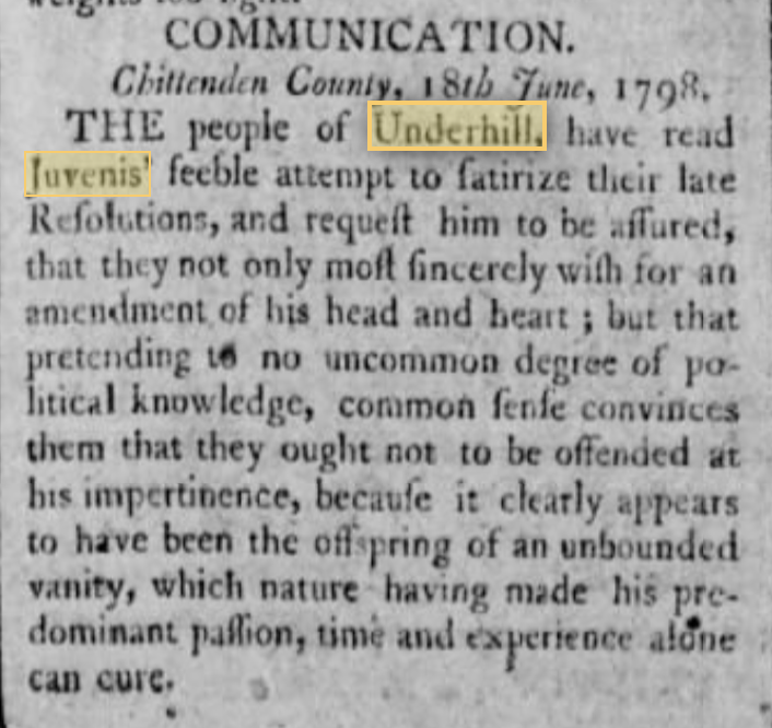
During the 1790s, Americans were divided between whether the United States should more closely align itself diplomatically with Britain or France. Federalists tended to favor Britain for cultural and economic reasons while Democratic-Republicans tended to prefer France. In 1798, amid growing tensions between the new French Republic and U.S., a diplomatic incident known as theContinue reading “The Underhill Resolutions 1798”
7 Cemeteries of Underhill
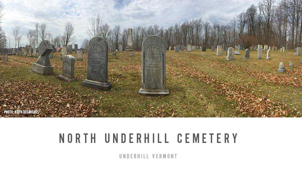
Our past can be recalled by a simple stroll through any one of Underhill’s seven cemeteries.
Underhill, Vermont | Past, Present and Future
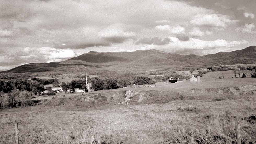
Preface In writing a history of Underhill, it is impossible to leave out the section of Jericho known as Riverside, which is so intimately associated physically, economically and socially with the area of Underhill referred to as Underhill Flats. Riverside is a small area adjacent to the Town of Underhill and separated from larger JerichoContinue reading “Underhill, Vermont | Past, Present and Future”
J.J. Monahan’s History of Underhill
CHAPTER XXX: HISTORY OF THE TOWN OF UNDERHILL THIS is a mountainous town situated in the northeastern corner of Chittenden county. It is bounded north by Cambridge, east by Stowe, the boundary line being the highest elevation of land on Mount Mansfield, on the south by Bolton and Jericho, and west by Jericho and Westford. ItContinue reading “J.J. Monahan’s History of Underhill”
Original Lots of Underhill
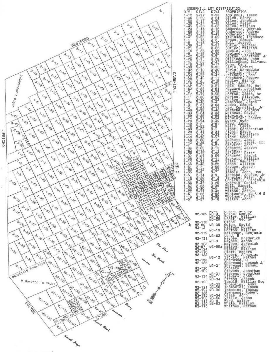
Names of Underhill lot owners taken from Underhill Surveys (1785-1804) in the Underhill Town Office, Mansfield lots taken from map titled “Plan of Mansfield Chartered June 8, 1763”.Names of Mansfield Owners taken from “Plan of Stowe” drawn by F.H Dewart (1913) located in Stowe Town Office. Underhill lots traced by Harris Abbott (1968) from map of James Thorp (c.1900).Map adjustedContinue reading “Original Lots of Underhill”
Udney Hay Estate
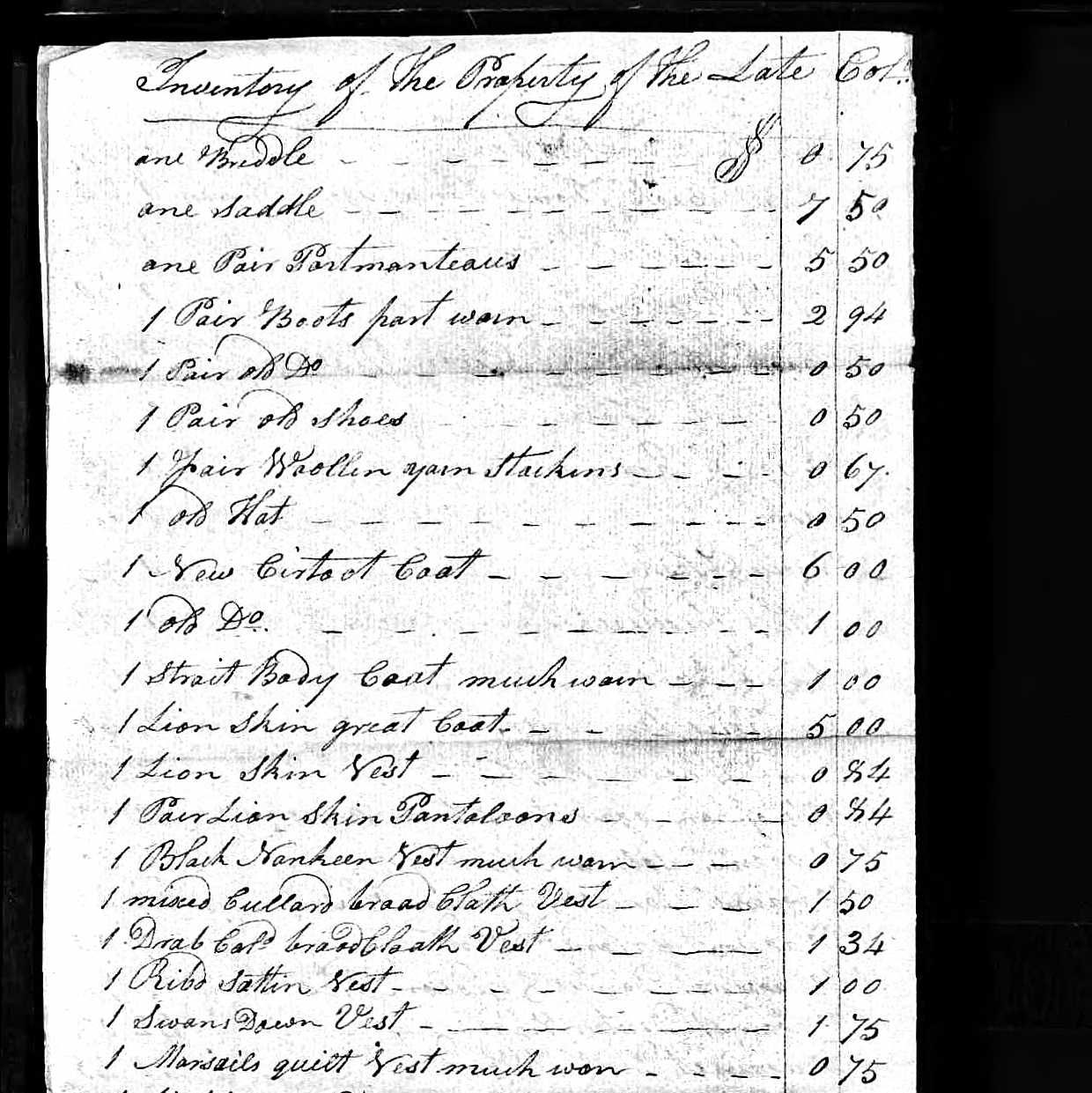
Probate records of estate inventories can provide us with a glimpse into the daily life of a time and place. Here is part of the estate of Lt. Col. Udney Hay who lived in Underhill 1796-1806. Some items of note: 1 Lion skin great coat and 1 lion skin vest: Despite his affiliation with theContinue reading “Udney Hay Estate”
